xi'an through the dynasties
zhou → qin → han → tang → ming
the tang city was 7x bigger than the walls you see.
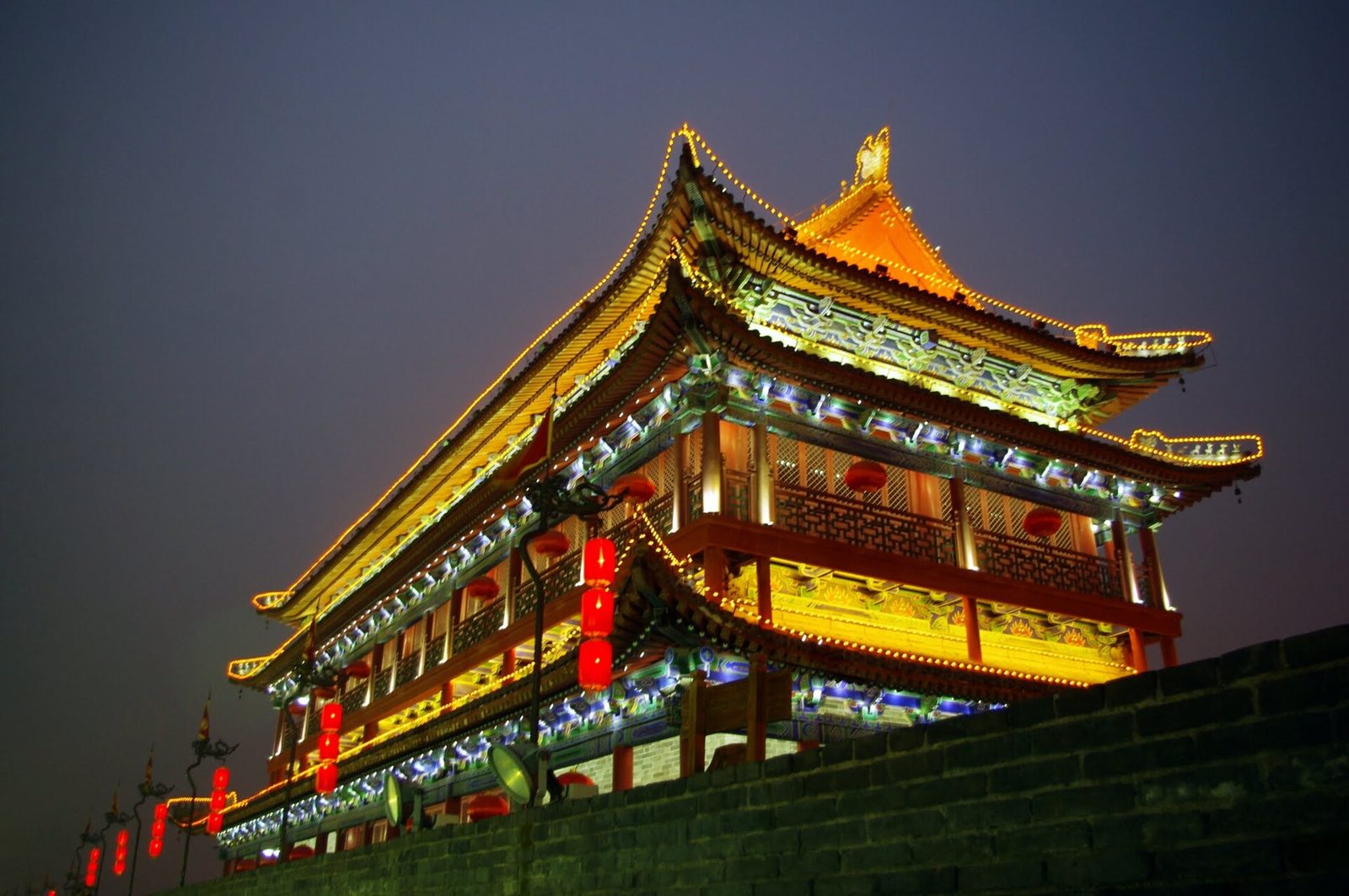
- xi'an (old chang'an) was a capital, on and off, for over a thousand years: western zhou, qin (next door), western han, sui and tang, plus a few shorter dynasties.
- around 700 ad, tang chang'an was very likely the biggest city on earth: about 84 km² inside the walls, a grid of 108 wards, roughly a million people.
- most of it is gone, so this walk anchors each era to a real place: banpo, a zhou chariot pit, the terracotta army, hanyangling, the daming palace, the big wild goose pagoda, the beilin, the ming wall, the great mosque.
- the old city you'll stay in is the ming one (1370s), built on and around the old tang government quarter, a fraction of the tang city.
here’s the strange thing about xi’an: it was one of the greatest cities in human history, and you can’t see most of it.
the walls you’ll bike along are ming, from the 1370s. the tang capital they replaced was about seven times bigger, and it’s under the apartment blocks, ring roads and wheat fields around you. the han city before that is grassy mounds. the zhou capital before that is mostly farmland. xi’an’s history isn’t stacked up neatly like a museum. it’s spread out across the plain, a layer for every dynasty.
so instead of one walk, this is a time walk: one real place you can stand in for each era, oldest to newest. some are blockbusters (hi, terracotta army). some are humble. one is honestly mostly gone, and i’ll say so.
the walk, dynasty by dynasty
- c. 4800–4200 bcneolithic (yangshao culture)
banpo neolithic village 半坡遗址
before anyone was an emperor, people were farming millet on the banks of the chan river, a few km east of today's city. banpo is a yangshao-culture village roughly 6,000 years old: about 5–6 hectares of round and square houses, many sunk a meter into the ground with thatched roofs, ringed by a moat several meters wide, with pottery kilns and a cemetery outside the ditch. it was found in 1953, excavated 1954–57, and in 1958 became china's first museum built over a prehistoric site. their painted pottery is famous for a mysterious human face with fish around it.
look for → the outlines of the house floors and post holes under the big roof, and the moat cutting through the village. then find the 'human face and fish' basin (in the galleries or as a replica) and decide for yourself what it means: nobody knows for sure.
~$8 (check opening days before you go); book on the museum's wechat mini-program or buy at the gate with a passport. about 30–40 min by taxi from the old city, and easy to pair with the terracotta army on the same day.
photo: Will Clayton from Blackburn, UK · CC BY 2.0 - c. 1046–771 bcwestern zhou
fenghao, the western zhou capital 丰镐遗址
this is where xi'an's capital story really begins, and also where you'll need the most imagination. the zhou kings built twin capitals, feng and hao, on either bank of the feng river southwest of the modern city, and ruled from here for nearly three centuries; it's often called the first city in chinese history to be called a 'capital'. in 771 bc hao was sacked and the court fled east to luoyang. there are no standing walls or palaces left: fenghao survives as farmland and excavated foundations, plus burial pits like the chariot pits at zhangjiapo, where real chariots were buried with their horses.
look for → if you get to the chariot pit, look at the ghost-shapes of the wooden wheels, spokes and all, preserved as imprints in the soil, with the horse skeletons still in harness position. about 600+ years older than the terracotta army.
honest version: this one's for keen history nerds. a small western zhou chariot pit exhibit near mawang town in chang'an district has opened and closed over the years, so check current status before the long taxi ride. the easy alternative is the zhou bronzes at the shaanxi history museum (free, but reserve days ahead with your passport).
photo: Danielinblue · CC BY-SA 3.0 - 221–210 bcqin
qin shi huang's terracotta army 秦始皇兵马俑
strictly, the qin capital was xianyang, just across the wei river, not xi'an, but the region was the qin heartland and the first emperor chose to be buried here, at the foot of mount li. qin shi huang unified china in 221 bc and standardized the script, coins, weights and even axle widths, and he planned a tomb to match. in 1974 farmers digging a well hit fragments of a clay soldier. the pits since uncovered hold an estimated several thousand life-size figures, each face individually finished, arranged as a full army facing east. the emperor's own burial mound, a short ride away, has still never been opened.
look for → in pit 1, stop looking at the rows and look at single faces: different hairstyles, mustaches, expressions. then find the faint patches of paint at the conservation area. the warriors were originally brightly colored.
~$17 (mar–nov) / ~$14 (dec–feb), includes the pits and the lishan garden at the mausoleum. book on the official channel, released 7 days ahead; ignore touts at the bus stops. about 1 hour from the city by tourist bus 306/5 or the metro + shuttle.
photo: Gary Todd · CC0 - 202 bc–ad 8western han
han chang'an + hanyangling 汉长安城 · 汉阳陵
the han founder, liu bang, set his capital just south of the burned qin capital and named it chang'an, 'perpetual peace'. his chancellor xiao he built the weiyang palace around 200 bc, and the walls went up in the 190s bc. from here, the han sent zhang qian west in the 130s bc on the missions that opened the routes later called the silk road. today the city is rammed-earth platforms and grass northwest of the modern center, a unesco site since 2014. for the han up close, go to hanyangling, the tomb of emperor jing (r. 157–141 bc): pits packed with small figures of soldiers, servants and animals, roughly a third life-size.
look for → at hanyangling, walk the glass-floored underground gallery over the actual pits. the human figures look armless and naked because their arms were wood and their clothes silk, and both rotted away 2,000 years ago.
hanyangling: ~$10 (cheaper in winter), near the airport, so it's a good first or last stop. the weiyang palace site park is open-air on the northwest edge of the city; check current hours before you go.
photo: Thebrainchamber1 · CC BY-SA 4.0 - 582–904sui · tang
sui-tang chang'an + the daming palace 隋唐长安城 · 大明宫
in 582 the sui emperor wen ordered a brand-new capital southeast of the old han city, designed by the engineer yuwen kai. the tang renamed it chang'an and around 700 it was very likely the largest city on earth: about 84 square km inside the walls, a population usually estimated at around a million, a strict grid of 108 walled wards locked at night, an east market and a west market, and a central avenue, zhuque street, about 150 m wide. the daming palace, begun in 634, became the main imperial seat from 663, a palace complex several times the size of beijing's forbidden city. it was wrecked in the wars at the end of the tang, and in 904 the city was dismantled and the capital moved east. chang'an never got it back.
look for → at the daming palace park, the danfeng gate and hanyuan hall are modern protective shells and markers built over the original foundations, so you can feel the real scale. walk from the gate to the hall: those were the emperor's distances.
the outer park is free; the core ruins zone with the site museums is ~$8.50. it's in the north of the city near daminggong xi metro (line 4).
photo: xiquinhosilva · CC BY 2.0 - 652 · rebuilt c. 704tang
big wild goose pagoda + xuanzang 大雁塔
the monk xuanzang left chang'an in 629, walked to india, studied there for years and came back in 645 with hundreds of buddhist texts. the tang court set him up at the da ci'en temple, which the crown prince (later emperor gaozong) had built for his late mother, and in 652 a pagoda was raised there to store the scriptures. the first, rammed-earth version decayed and it was rebuilt in brick in the early 700s under empress wu zetian. at about 64 m it's one of the few tang buildings still standing in a city that has lost almost everything else from its golden age. xuanzang's journey later became the novel 'journey to the west', the one with the monkey king.
look for → the slight lean (it's been tilting for centuries), the simple square tang profile compared with fussier later pagodas, and the statue of xuanzang out front with his staff. the north plaza has a big musical fountain show in the evening.
temple ~$5.50 plus ~$3.50 extra to climb the pagoda (prices have shifted lately, so check on site). metro: dayanta (lines 3 & 4). the fountain show on the north square is free.
photo: Gary Todd from Xinzheng, China · CC0 - 781tang
the silk road start: west market + the nestorian stele 大唐西市 · 大秦景教流行中国碑
tang chang'an's west market was where the silk road came home: sogdian, persian and other foreign merchants traded horses, spices, glass and silver for silk. a museum now stands on part of the excavated market site. to feel how mixed the city really was, go to the beilin museum and find a stele carved in 781: it records the arrival of the 'luminous religion', church of the east christianity, in 635, written in chinese with names in syriac. it was buried, probably in the 9th-century religious crackdowns, rediscovered around 1625, and moved to the beilin in 1907.
look for → at the beilin, the syriac script running along the base and sides of the nestorian stele, and the small cross at the top above the chinese title. at the west market museum, the excavated paving and wheel ruts of tang streets under glass.
tang west market museum: free with passport, closed mondays. beilin museum: ~$12 since its 2025 expansion, a short walk from the south gate; the stele is in one of the old numbered galleries.
photo: David Castor · Public domain - 1370–1378ming (hongwu)
the ming city wall 西安城墙
after the tang, xi'an was a regional city, not a capital, and its walls shrank to match. in the 1370s the first ming emperor, hongwu, had a new wall built on the line of the old tang imperial-city walls, which is why the 'old city' is only a fraction of tang chang'an's footprint. at about 13.7 km round, with a moat, gate towers, barbicans and regular watchtowers, it's one of the most complete city walls left in china. it was faced with brick in later centuries and restored heavily in the 1980s.
look for → the regularly spaced bastions sticking out from the wall: they let defenders shoot along the face of the wall at anyone climbing it. at the south gate (yongningmen), look at the barbican, a walled trap between the outer and inner gates.
~$7.50 to go up; bikes ~$6 for 3 hours, and one full loop takes about an hour by bike. open into the evening, and sunset is the move. most people go up at the south gate (yongningmen metro, line 2).
photo: xiquinhosilva · CC BY 2.0 - 742 (trad.) · 1392tang roots · ming building
the muslim quarter + great mosque 回民街 · 化觉巷清真大寺
the lanes behind the drum tower are home to xi'an's hui muslim community, whose roots go back to the arab and persian traders and settlers who came along the silk road from the tang onward. tradition dates the great mosque on huajue lane to 742, but the complex you walk through today was largely built from 1392 under the ming and expanded later. it's a mosque in the form of a chinese temple: courtyards, carved stone gateways, glazed-tile roofs, and an octagonal pagoda-like tower where a minaret would be.
look for → the orientation. chinese temples face south, but this whole complex runs east to west so the prayer hall faces mecca. it's the beijing-axis logic of the rest of this walk, rotated 90 degrees. and look for arabic calligraphy carved in chinese-style stone and wood.
mosque ~$3.50 (cheaper in winter), free for muslims; dress modestly, and the prayer hall is for worshippers only. avoid friday midday prayers. then eat your way down the lanes: roujiamo, biangbiang noodles, yangrou paomo.
photo: Ovedc · CC BY-SA 3.0
why here? the “land within the passes”
xi’an sits in the guanzhong basin, literally the “land within the passes”: a fertile plain along the wei river, walled in by the qinling mountains to the south and loess plateau to the north, with a handful of defendable passes in. for an early empire that was perfect. you could feed an army, block the doors, and still reach the northwest routes into central asia.
that’s why so many dynasties chose it. chinese sources traditionally count 13 dynasties with their capital in or right next to xi’an, though the count depends on whether you include short-lived regimes and capitals that were technically in neighboring xianyang. the big four are the western zhou, qin, western han and sui-tang, and they cover most of china’s first 2,000 years of imperial history.
and when the money and the grain moved east and south after the tang, the capital followed. by the 10th century xi’an had become a provincial city, which is exactly why it still has the wall.
a city of three cities
to make sense of what you’re seeing, picture three outlines on the same map:
| era | what you can see | rough scale |
|---|---|---|
| western han chang’an (from 202 bc) | earth platforms of the weiyang palace, northwest of today’s city | roughly 35 km² |
| sui-tang chang’an (582–904) | the daming palace site, the two goose pagodas, street ruts at the west market | about 84 km² |
| ming xi’an (1370s →) | the full city wall, bell & drum towers, the old city you’ll stay in | about 11–12 km² |
the tang city was a deliberate, almost modern grid: a palace city and imperial city at the north center, a 150-m-wide avenue (zhuque street) running due south, and 108 walled wards on either side, each with gates that closed at night to a drumbeat. two big markets, east and west, were the only places you were supposed to shop. it was designed by the engineer yuwen kai for the sui in 582, and the tang just moved in and kept going. later planners copied the layout across east asia: japan’s heijō-kyō (nara) and heian-kyō (kyoto) were laid out on chang’an’s model.
when the ming built their wall in the 1370s, they reused the walls of the old tang imperial city, the government quarter, and extended them to the north and east. so the whole “old city” of today covers roughly what was once the bureaucrats’ district plus a bit. walk out of the south gate and down to the big wild goose pagoda, about 4 km, and you’re still inside where tang chang’an’s walls stood.
the silk road started at the west market
“the silk road” is a 19th-century european name for a network, not a road, but if it has a hometown it’s chang’an. the han envoy zhang qian set out west from here in the 130s bc; by the tang the west market was full of sogdian, persian and turkic traders, and the city had zoroastrian, manichaean and christian temples alongside buddhist and daoist ones (if those two blur together, read buddhism, daoism and confucianism explained). unesco’s 2014 silk roads listing includes several xi’an sites: the han weiyang palace, the daming palace, both goose pagodas and the xingjiao temple pagoda.
the best single object for this is the nestorian stele in the beilin museum: a tang stone from 781 that records christian missionaries arriving in 635, carved in chinese with syriac names. it’s one of those moments where history suddenly looks a lot more connected than the textbook made it seem.
i spent way too long in front of it. a guard eventually came and stood next to me, not to move me on but, i’m pretty sure, to see what i was looking at. we both stared at the syriac for a while. great afternoon.
how to do it in two or three days
- day 1, east of the city: banpo in the morning, then the terracotta army and the qin shi huang mausoleum (the lishan garden is on the same ticket). long day, worth it.
- day 2, the tang day: daming palace in the morning, then the big wild goose pagoda, then the beilin museum and the west market museum. evening: the musical fountain at the big wild goose pagoda’s north square.
- day 3, the ming and the muslim quarter: bike the city wall at sunset, then the great mosque and dinner in the lanes. (for how religion in china works today, see what do chinese people believe.) squeeze in hanyangling on your way to or from the airport, since it’s right by it.
getting here: xi’an is about 4.5–6 hours from beijing by high-speed train, and the station (xi’an north) is on metro line 2. our china train guide has the booking walkthrough. if you’re coming from the beijing central axis, you’re basically going from where the last emperors ruled to where the first ones did. nice bookends.
where to stay: inside the walls for the wall-at-sunset and muslim-quarter-dinner life, or near the big wild goose pagoda for the tang side. more in our xi’an guide.
food note: the dynastic theme runs into dinner too. roujiamo is often pitched as “the world’s oldest burger” (cute marketing, shaky history), and yangrou paomo, crumbled flatbread soaked in mutton broth, is the old city’s signature. more in our chinese food guide.
the vibe check
xi’an rewards imagination more than any city in china. the terracotta army is the headline, but the real wonder is standing on the ming wall at dusk, looking south over the traffic, and knowing that 1,300 years ago the biggest city on earth ran out to the horizon with a million people in it: monks back from india, persian merchants in the west market, poets getting drunk in the wards. almost all of it is gone. the places in this walk are the pins that hold the story down. go see them in order and the city stops being “the terracotta warriors place” and becomes what it actually was: the capital where chinese empire was invented.
the kit for this trip
heads up: some links above are affiliate links. if you book through them we earn a small commission at no extra cost to you — it keeps this guide free. more on that.